|
 Mission Statment Mission Statment
GEA Mapping promotes the total knowledge of location Intelligence by being a leader in the Geospatial Technology company providing mapping products including Topographic mapping, 3Dmapping, Land Surveying, Geo databases, Consultancy and Training.
Objective 1
To perform applied research in the areas of geomatics engineering, transportation system planning & design, security and emergency management systems, information technology, navigation technologies, utility system planning and design, and geophysical studies.
Objective 2
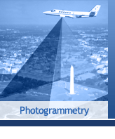
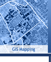
To provide training programs in the areas of GPS, digital photogrammetry and remote sensing, GIS/LIS, and QC/QA.
Objective 3
To integrate Geomatics Services with other information systems and provide turnkey solutions to clients worldwide.
Commitment to Diversity
GEA Mapping maintains an affirmed commitment to diversity of Human knowledge, Environment awareness. Regardless of any religion, gender, race, nationality or ethnic background.
|
 |
GEA Mapping in-house knowledge and experience encompass a broad range of surveying disciplines; topographic survey, internal and exterior measured building surveys, aerial and terrestrial photogrammetry, structural monitoring, underground service tracing, GPS, and arboricultural surveying are also available.
Projects can be a simple or as complex as our clients determine, or the nature of the site demands. In some instances it may be advantageous to combine more than one surveying discipline within a single project. For example, whilst conducting a topographical survey prior to design and construction, we may be required to incorporate an underground services tracing exercise to map the location of buried utilities as part of our final project.
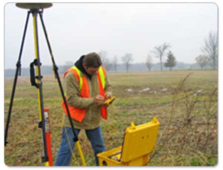
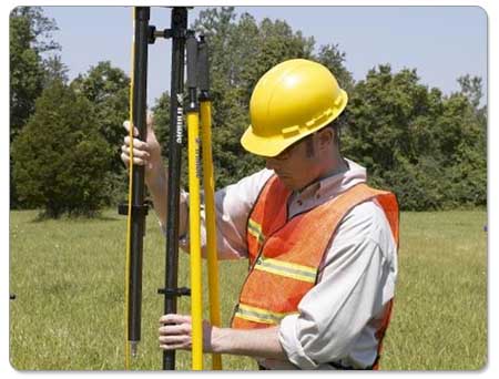
Our primary tool for data capture is Electronic Distance Measurement (EDM) technology in the form of standard or reflectorless Total Stations. Such instruments provide measurements for three-dimensional co-ordinates, the resulting information being stored electronically via an on-board Data Logger.
Once the field portion of a survey is complete, the data is downloaded in the office for manipulation and quality control checks using the latest ????software. Once an accurate digital model of the terrain and feature location has been created, this data is transferred to our CAD department where final manipulation and annotation is performed using the latest versions of AutoCAD™ and AutoCAD-LT™.
Our Services
Our products and services centre upon improving our clients' business performance across the whole of the asset life cycle, from planning and creating, through to operation.
The services we provide can be applied at any point within this cycle and take the form of consulting, managing delivery or the delivery of business support, maintenance and construction.
LAND SURVEYING
-
Topographical Survey: this is a survey of selected natural and artificial features of a part of the earth’s surface to determine horizontal and vertical spatial relations.
-
Site surveys: birds eye view and worms eye view; we include block plans of existing buildings, boundary walls, any other walls and permanent structures on site. Electricity poles, man holes, tress and any other important features.
-
Building Surveys: block plan of existing building by carrying out a roof survey and/or internal survey of existing which include: door & window schedule, floor to ceiling height tied to a datum, electrical layout of existing, sectional elevations and external elevation
-
Survey Sheets: hard copy or digital
-
Levels: spot levels at requested grid; datum for tile laying and soffit laying; datum for excavation
-
Monitoring of walls and building to study movement in verticality, grid control and control points
-
Volumetric Surveys: levels pre and post excavation
-
Setting Out: bore holes, excavation boundaries, foundations, plinths & columns, position of tower cranes, building layout, tile patterns, suspended ceiling layout including services, parcelling of plots
-
Building Extensions: existing plans to accommodate proposed
-
Street Surveys: measuring all street furniture, door sills and openings, garage openings and house names and numbers
-
Bathymetric Surveys
-
Underwater Cave Surveys
-
Contract Plans: A survey, the primary purpose of which is to document the perimeters, or any one of them, of a parcel or tract of land by establishing or re-establishing corners and boundary lines for the purposes of a sale of land enabling the buyer or the vendor to locate their perimeters both on plan and on site.
-
Boundary Disputes: Unlike the surveyors of old, the modern day surveyor is aided by electronic equipment, computers, and better record-keeping to achieve accuracy unparalleled in history. Certain needs are obvious; our population has expanded and more efficient use of our land must be made. As the costs of land spiral upward, the delineation of property lines has become more critical. New divisions of land will continue to be made each day, and the old surveys will have to be retraced.
-
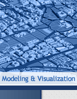
3D Modelling: proposed building, existing building, digital terrain modelling, digital hydrographical modelling, volumetric models, contours at requested intervals, sections at requested longitudinal intervals, close range photgrammetry, 3D textured model, rectification in colour or black & white
|